If you are planning a trip to Ha Giang Province in northern Vietnam, this four-day-and-three-night travel guide by Minh Huyen is hoped to be helpful for you to have the most interesting and meaningful journey.
Ha Giang Province’s tourism is gradually getting back on track, with the peak from the autumn this year to the spring next year.
During this period, tourists in southern Vietnam tend to visit the northern region to soak up the unique cold air, enjoy new views and experience cultural features in the region, widely known as a poetic place.
Here’s a detailed itinerary and travel tips for Ha Giang visit:
Day 1: The first 100 kilometers
Getting on a passenger coach at the My Dinh coach station in Hanoi City at 7:00 pm, you will be in Ha Giang City in the early morning of the following day after a good sleep.
The heart of the city is home to countless hotels and lodging facilities with motorcycle rental services.
You can embark on an exciting and adventurous journey to the spectacular rock plateau with a temperature-monitoring patch on back, luggage tied to the back of a motorbike, comfortable warm clothes, sneakers, mittens, eyeglasses, and identification documents.
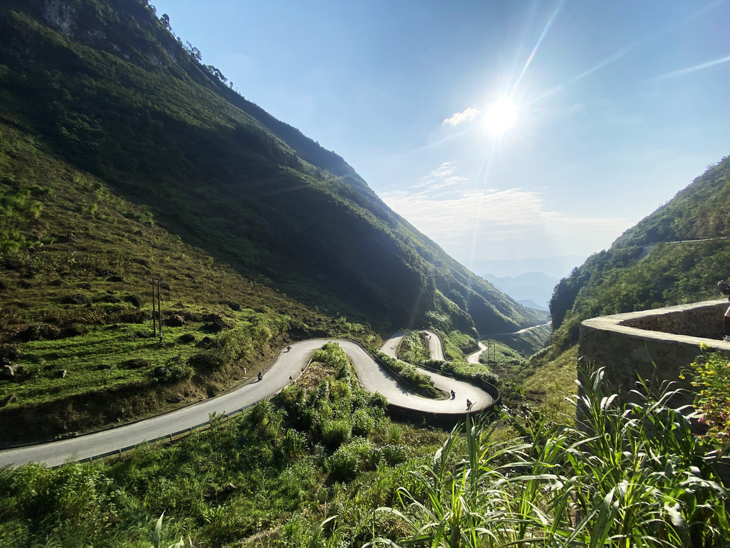
Quan Ba Heaven Gate in Quan Ba District is the first jaunt with a long and winding path and higher altitudes.
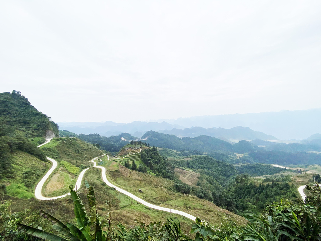 |
| Quan Ba Heaven Gate - a tourist attraction in Quan Ba District, Ha Giang Province, Vietnam. Photo: Minh Huyen / Tuoi Tre |
The wind howls and the temperature falls as low as five degrees Celsius. Even a cup of hot coffee or cocoa could not maintain its warmth for three minutes.
Take a sip of the drink and enjoy the magnificent scenery, you can immerse yourself into the sights, sounds and smells of the mountainous land.
On the way, you also have to stop at a famous “lonely” tree on National Highway 4C in Can Ty Commune, still in Quan Ba District. This is one kind of preserved precious Burretiodendron hsienmu.
The tall and big tree stands at the edge of the hill. Many tourists will not find it out easily unless locals show them the way.
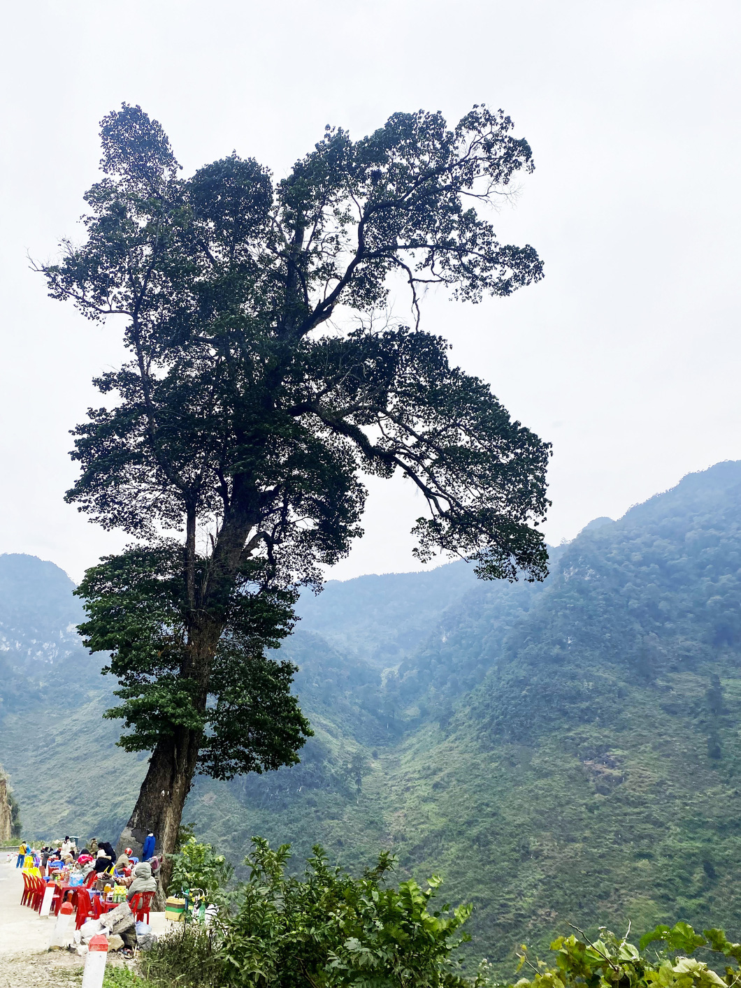 |
| The famous 'lonely' tree - a tourist attraction on National Highway 4C in Can Ty Commune, Quan Ba District, Ha Giang Province, Vietnam. Photo: Minh Huyen / Tuoi Tre |
Next, stopping at Tham Ma Slope in Dong Van District to look back at a section of the stunning pass that you have conquered is deeply interesting.
The slope, in the past, was used to test strong horses, but now becomes an emerging tourist spot.
The mountainous setting and surroundings, plus afternoon sunlight appearing from mountain creeks, draw a charming picture.
The sound of flutes played by ethnic minority boys is extraordinarily enticing.
The first day of a Ha Giang trip is rounded off with a visit to the Vuong Palace, known as the palace of Mong King Vuong Chinh Duc, in Dong Van's Sa Phin Commune.
This is a historic building that features a mix of the cultures of the Mong ethnic group, France and China.
The building was constructed in 1898 and completed nine years later.
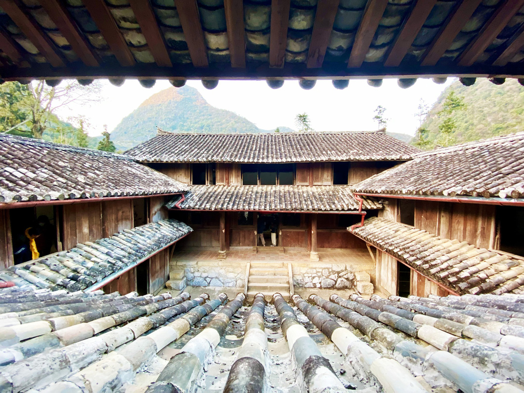 |
| The Vuong Palace, known as the palace of Mong King Vuong Chinh Duc, in Dong Van District, Ha Giang Province, Vietnam. Photo: Minh Huyen / Tuoi Tre |
Tourists can learn about the regal style of the noble family in the 3,000-square-meter palace with multiple delicately-constructed rooms.
It is strongly recommended that tourists should head to Dong Van Town at 5:00 pm to avoid the dark and be able to enjoy a hearty hotpot dinner at 7:00 pm.
Day 2: 95-kilometer exploration journey
On the second day, if lucky, you can join the market day at the heart of Dong Van Town, enjoying a joyful atmosphere with crowds of vendors and buyers and trying local delicacies.
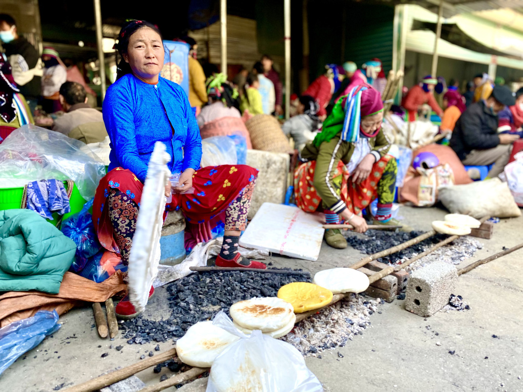 |
| A picture of vendors on market day at the heart of Dong Van Town in Dong Van District, Ha Giang Province, Vietnam. Photo: Minh Huyen / Tuoi Tre |
Having breakfast and taking a sip of coffee at Tam Giac Mach Coffee Shop at Dong Van’s old town will be a fresh start for a new jaunt to Dong Van's Lung Cu Commune.
The Vietnam’s northernmost point and the Lung Cu flagpole in Lung Cu Commnue are two different venues, but many people mistakenly think they are one.
The two tourist attractions lie some three kilometers apart.
The country’s northernmost landmark overlooks the border with China. Though the road leading to the venue is under repair, the surrounding scenery is unspoiled and poetic.
The Lung Cu National Flag Tower appears to contain the love of the country, radiating a feeling of sacredness. Taking a photo at the flagpole is recommended.
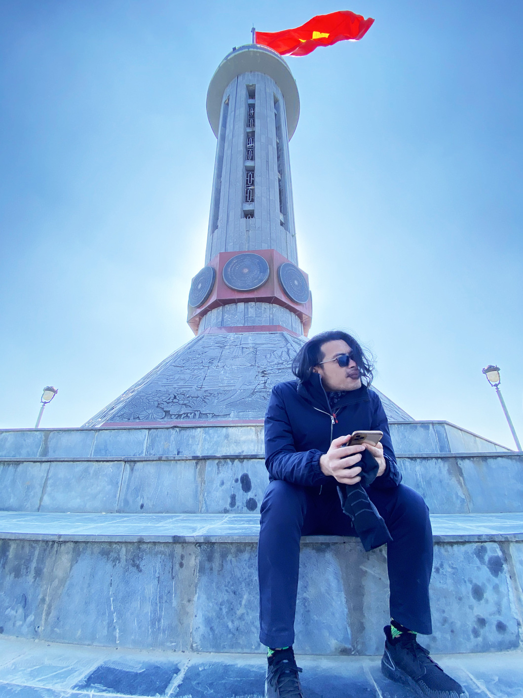 |
| A tourist poses at the Lung Cu National Flag Tower in Dong Van District, Ha Giang Province, Vietnam. Photo: Minh Huyen / Tuoi Tre |
Next, conquering Ma Pi Leng, one of the “Four Great Passes of Vietnam”, and Nho Que River, which looks like a soft green thread, should also be a spectacular experience to be added to the second day.
Starting a motorcycle ride, in the morning, to Ma Pi Leng Pass and the Nho Que River, you can explore such breathtaking trails and astounding landscapes.
A must-see destination for taking photos is the Tu San Canyon, where tourists can have the splendid views of the famous Nho Que River.
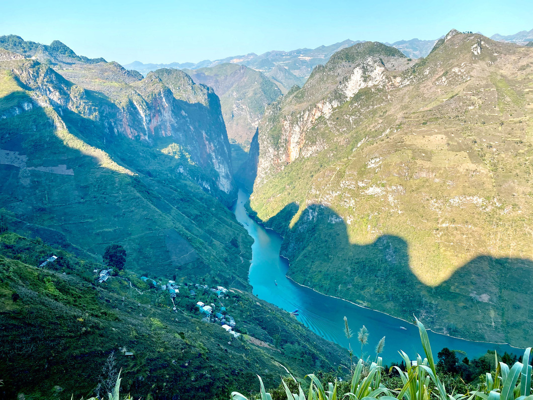 |
| Tu San Canyon overlooks the Nho Que River in Ha Giang Province, Vietnam. Photo: Minh Huyen / Tuoi Tre |
It is ideal to be present at the Nho Que river berth at 3:00 pm to watch the last rays of sunlight streaming at the flanks of the hill on the two sides of the river, and take a boat in the unique river with crystal-clear and green water.
Such a magic picture is only created by nature.
After that, a stop at the cultural-tourism Mong village in Meo Vac District wraps it up for the second day.
The highlights of the village are gorgeous homestays and specialties such as xoi nep cam, or black sticky rice, served with sesame salt and roasted pork or chicken.
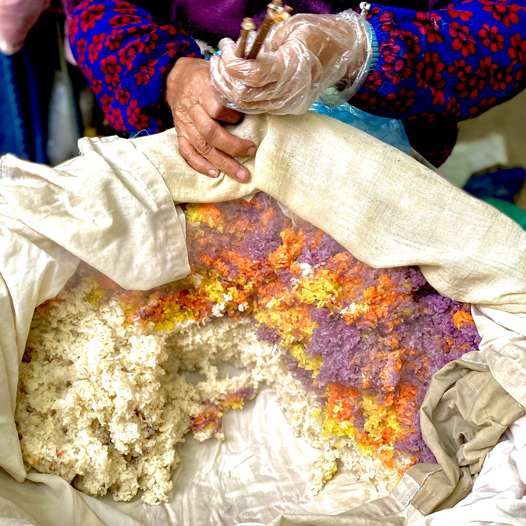 |
| 'Xoi nep cam' (black sticky rice) and 'xoi gac' (red sticky rice) cooked in baby jackfruit flesh at the cultural-tourism Mong village in Meo Vac District, Ha Giang Province, Vietnam. Photo: Minh Huyen / Tuoi Tre |
In the evening, you can stroll around the village, and then drink hot coffee or tea alongside a campfire in the cold.
Having grilled sweet potatoes or corn for dessert gives you a good sleep.
Day 3: Another 100-kilometer day
A 20-kilometer-long section of the road connecting Meo Vac District with Mau Due Commune in Yen Minh District is under repair, so tourists should carefully ride their motorbikes.
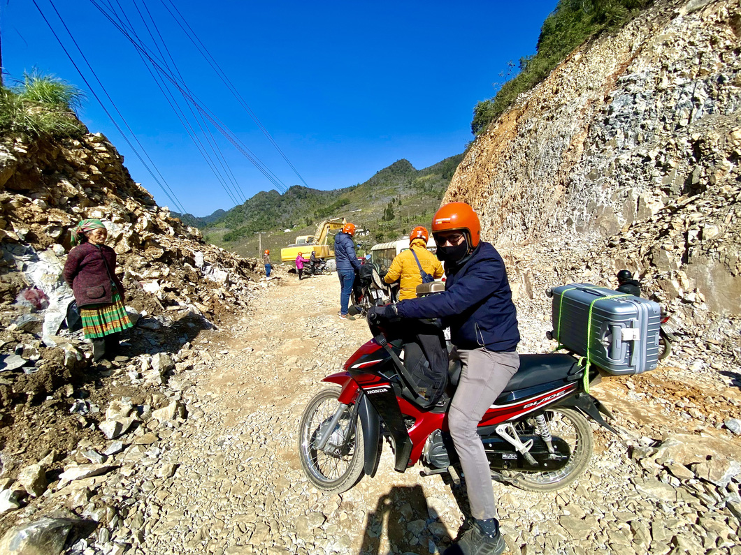 |
| A 20-kilometer-long section of the road connecting Meo Vac District with Mau Due Commune in Yen Minh District is under repair. Photo: Minh Huyen / Tuoi Tre |
The route is famous for its M-shaped pass, which is believed to symbolize money or luck meaning “May Mắn” in Vietnamese that starts with letter M.
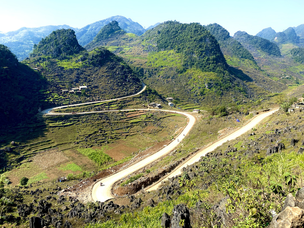 |
| The famous M-shaped pass on the route connecting Meo Vac District with Mau Due Commune in Yen Minh District in Ha Giang Province. Photo: Minh Huyen / Tuoi Tre |
After a break for lunch, you can continue to head toward the year-round-flowing Du Gia Waterfall, which is over five meters tall and nearly three meters wide.
The water of the stream below is clear and cool.
About four kilometers from Provincial Road 176 in Du Gia Commune in Yen Minh District, the cascade is hidden deep in the forest.
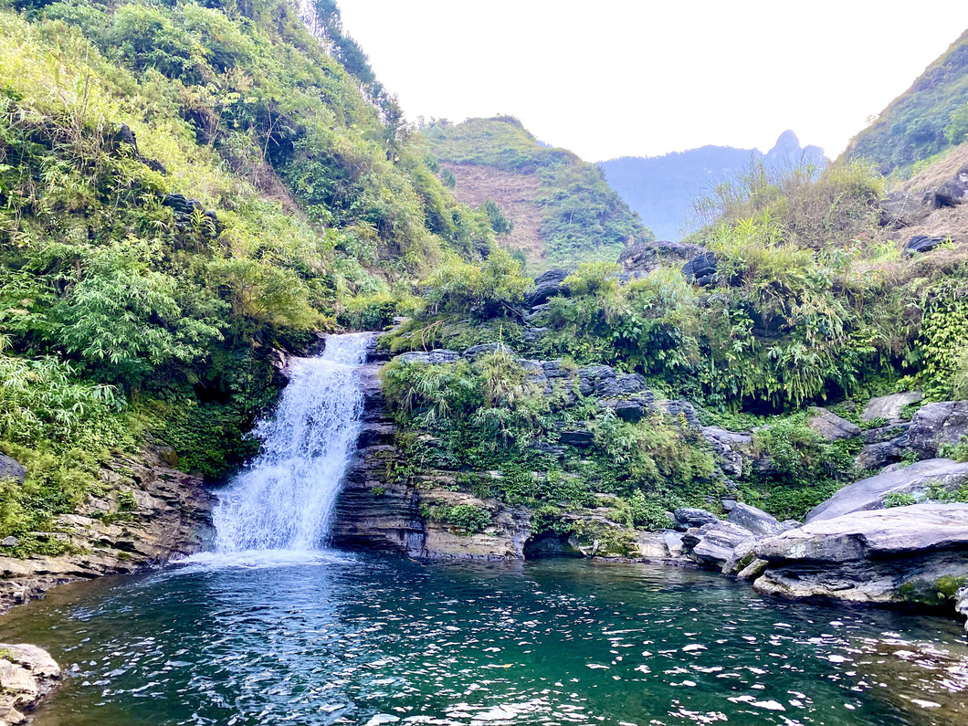 |
| Majestic Du Gia Waterfall. Photo: Minh Huyen / Tuoi Tre |
Tourists, with highly-skilled riding, can follow a small rugged path, traversing a village to approach the waterfall.
When the weather is warmer, visitors, especially foreigners, tend to take a dip in the freshwater to enjoy a moment of blessed calm and peace.
Du Gia Commune is home to numerous distinctive homestays, thereby no concerns over a dearth of accommodations.
The owners of these lodging facilities are very welcoming, bringing a feeling of closeness to guests.
Day 4: The final 110-kilometer journey
During the final leg of your journey, before getting back to Ha Giang City, you should stop by Lung Tam Village, which boasts the H’Mong ethnic group’s well-known linen weaving craft village.
A finished woven linen sheet undergoes as many as 41 steps.
On the Mien riverside, local women produce linen sheets every day to maintain their traditional weaving craft and attract more tourists.
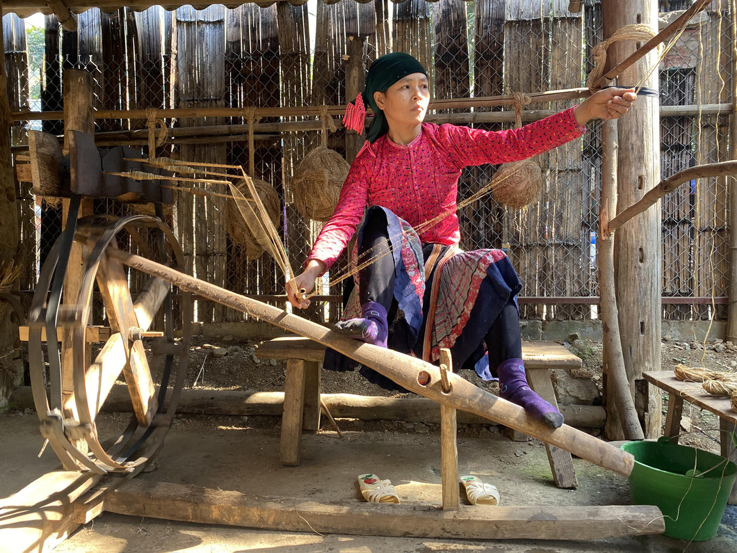 |
| A woman weaves linen at Lung Tam Village in Quan Ba District, Ha Giang Province, Vietnam. Photo: Minh Huyen / Tuoi Tre |
Woven linen sheets made in the village are durable regardless of unfavorable weather conditions.
The linen clothes woven by local women in the village keep wearers warm in the winter and cool in the summer.
The Mong ethnic minority people do cherish their colorful linen clothes.
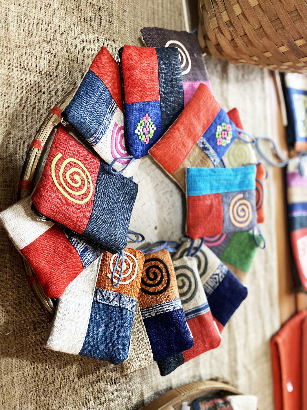 |
| Handicraft wallets made at Lung Tam Village in Quan Ba District, Ha Giang Province, Vietnam. Photo: Minh Huyen / Tuoi Tre |
Arriving in downtown Ha Giang City at about 4:00 pm, taking a group photo at the Kilometer Zero Landmark is one of the most impressive and memorable things during this epic journey.
This seems to be a promise for a comeback.
Like us on Facebook or follow us on Twitter to get the latest news about Vietnam!


