Ta Chi Nhu: A weekend getaway with transcendental sunset view in Vietnam
Thursday, December 24, 2020, 14:42 GMT+7


The seventh-tallest mountain of Vietnam, Mount Ta Chi Nhu, is known among the Vietnamese backpacker community as a spot offering a sublime 'cloud hunting' experience and a breathtaking sunset view.
At a height of 2,979 meters above sea level, Ta Chi Nhu can be found in Xa Ho Commune, Tram Tau District, located in northern Yen Bai Province.
It is part of Pu Luong massif, which in turn belongs to the renowned Hoang Lien Son range.
Ta Chi Nhu and Ta Xua are the two most popular mountains in Tram Tau District.
Climbing Ta Chi Nhu is by no means difficult – it takes about two weeks to prepare for the trip, including stamina and mental training, finding partners with adequate trekking skills, and observing weather.
The optimal time to climb Ta Chi Nhu is between September and March every year.
While Ta Xua is slightly harder to conquer, taking at least three days and two nights, a trip to Ta Chi Nhu only last two days and one night.
The two-way itinerary stretches a length of 18 kilometers, with only one straight route for the most part.
It is also considered a safe route for beginners with gentle slopes mixed with a few steep ones.
|
|
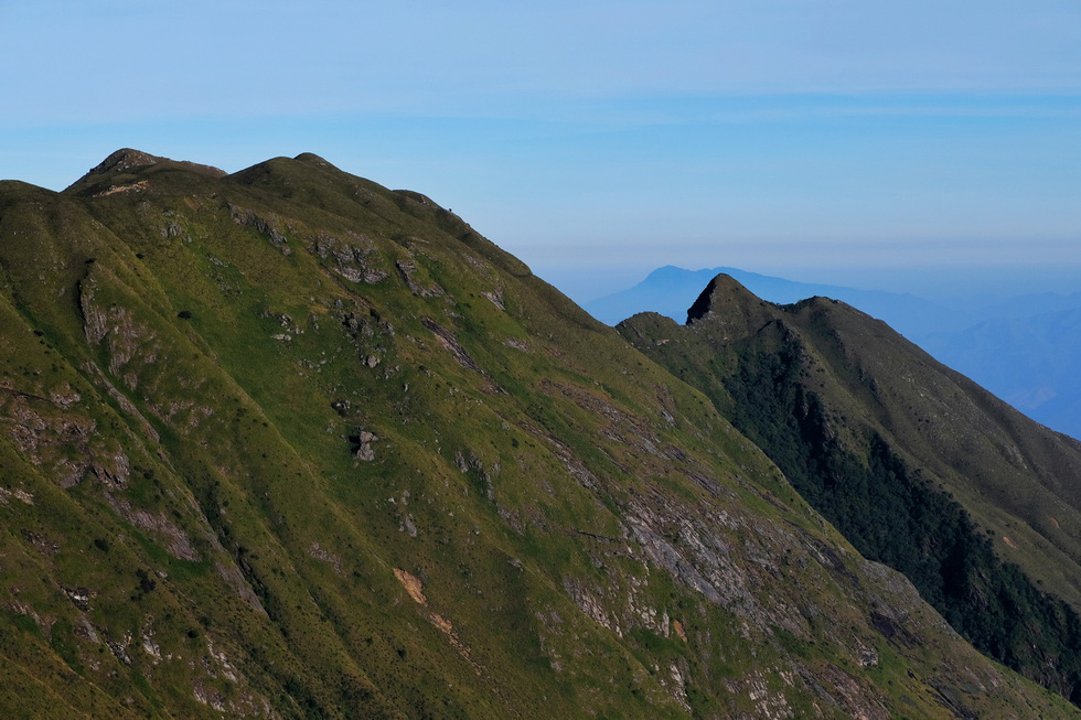
| A view from the route to Mount Ta Chi Nhu. Photo: Nguyen Chi Nam / Tuoi Tre |
A hike at Ta Chi Nhu can be divided into three legs.
The first one starts from the foot of the mountain, crossing through an active lead mine and finishing at a stream at an altitude of 1,200 meters – a perfect place for a lunch stop.
From this point, hikers will continue toward a cabin at 2,400 meters for their night stay.
Lastly, the cabin connects with the mountain’s peak for the final length of the journey.
What is interesting is the subtle terrain changes along the way – from the spreads of lower shade trees from the outset of the journey, the scenery gradually transitions to those of streamlets, bamboo forest, and lush meadows before entering the bare hills near the end.
|
|
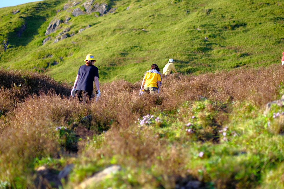
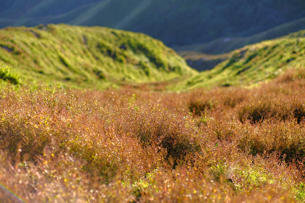
| Lush meadows are seen along the route to Mount Ta Chi Nhu. Photo: Nguyen Chi Nam / Tuoi Tre |
|
|
| Lush meadows are seen along the route to Mount Ta Chi Nhu. Photo: Nguyen Chi Nam / Tuoi Tre |
The last leg is considered the most rewarding track of the trip, as with the right timing, the hills in sight will be blanketed in an overwhelming tinge of purple from Swertia – a peculiar kind of wildflower.
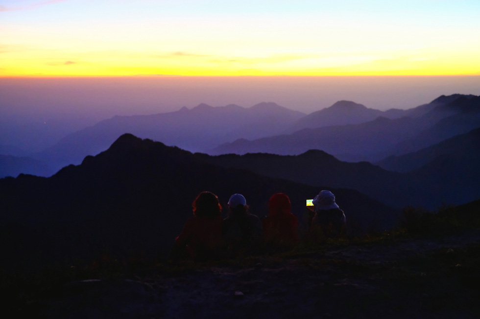
Trekking groups usually spend the only night on the trip at the cabin before going for 'cloud hunting' and sunrise spotting early the next day.
Others choose to rush the remaining 2.5 kilometers to the mountaintop, which may take 2-3 hours, within the first day and take in the blissful sunset view for themselves.
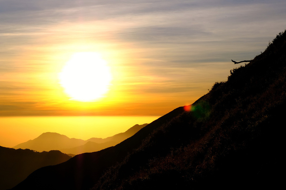
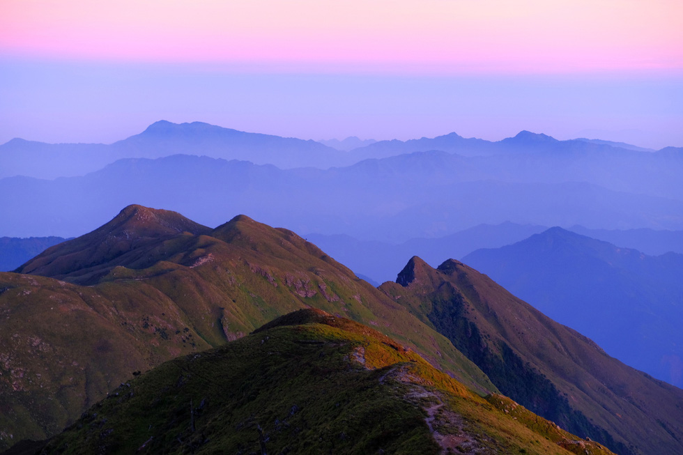
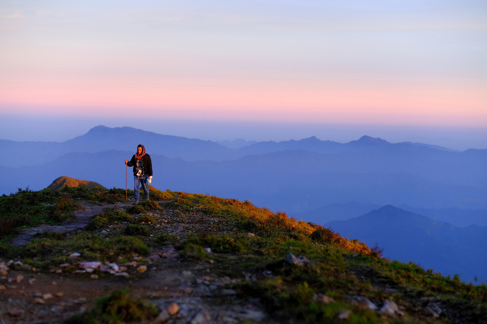
Being at the peak is without any doubt the paramount experience of the journey, as the bare hilltops open up a panoramic view of the majestic topography of the area.
Here, each traveler will find their own way to relish the transcendental experience when the last glints of daylight ebb into the distant horizon, shining pinkish, then purple glows before sinking into the depth of the night.
|
|
| Sunset is seen on the route to Mount Ta Chi Nhu. Photo: Nguyen Chi Nam / Tuoi Tre |
|
|
| A panoramic view from the route to Mount Ta Chi Nhu. Photo: Nguyen Chi Nam / Tuoi Tre |
|
|
| A panoramic view from the route to Mount Ta Chi Nhu. Photo: Nguyen Chi Nam / Tuoi Tre |
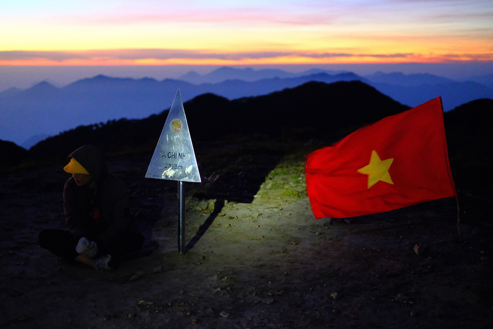
|
|
| The peak of Mount Ta Chi Nhu. Photo: Nguyen Chi Nam / Tuoi Tre |
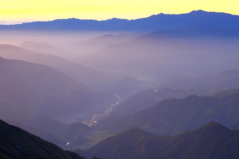
|
|
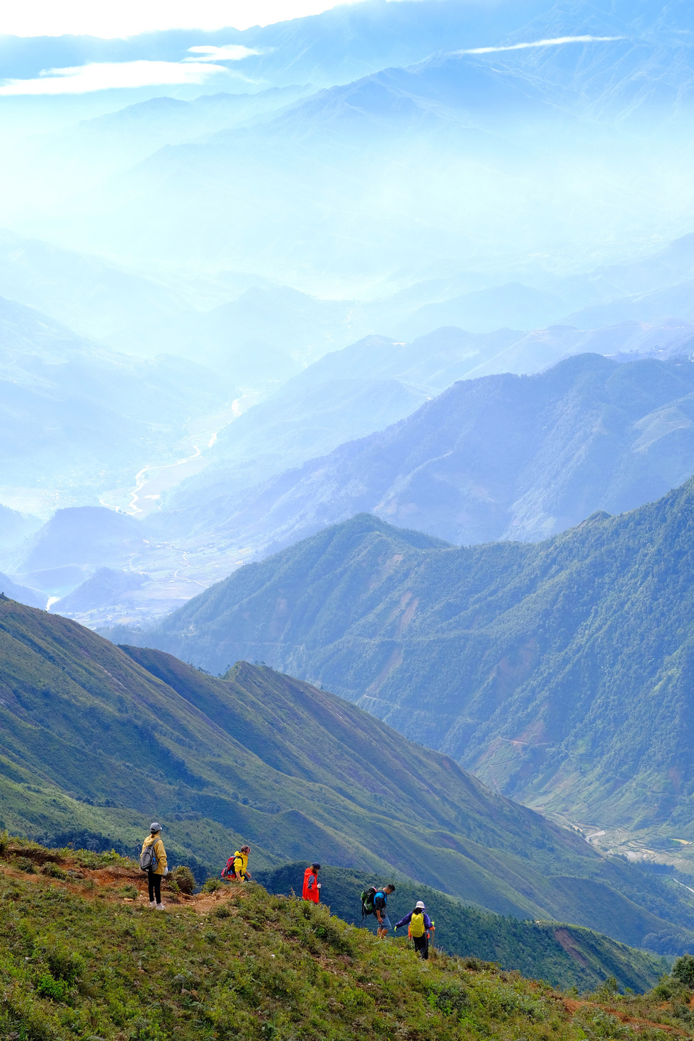
| The valley of Tram Tau District in Yen Bai Province is seen from Mount Ta Chi Nhu. Photo: Nguyen Chi Nam / Tuoi Tre |
|
|
| The way down from Mount Ta Chi Nhu. Photo: Nguyen Chi Nam / Tuoi Tre |
Like us on Facebook or follow us on Twitter to get the latest news about Vietnam!

The province has reported six cases of rabies, including two human deaths

The city earned VND56.662 trillion (US$2.2 billion) in tourism revenue in January-March

Before surpassing Soros, Vuong had overtaken U.S. President Donald Trump in the March 15 update of the Forbes list

The plants will produce beef, pork and poultry, and will mainly use raw materials imported from Brazil

The U.S. Geological Service's predictive modeling estimated Myanmar's death toll could top 10,000

The military and police teams are expected to arrive in Myanmar on Sunday

The hotel, located on Tran Phu Street, set up an excessive number of umbrellas and lounge chairs on the beach
Law enforcement will be on patrol to ensure that everyone follows the rule

Bich Dam is one of the most remote island villages in Nha Trang Bay

Ca Mau Province is home to around 90,000 hectares of mangrove forests
The house has been passed down through six generations

The area is renowned for its stunning natural scenery

The trend of collecting stamps in the ‘Ha Giang Passport’ emerged on social media in late January